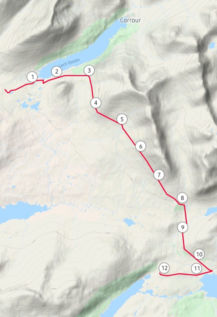
Following my triumphant return to bothying in August, with my excellent trip to Craig bothy, I was keen on having some more adventures. I want to do some more bothies, but decided when I had a free day recently to try something a little different – a trip along the spectacular West Highland Line to the unique and remote station at Corrour, then a walk across the wilds of Rannoch Moor to Rannoch station, from where I’d catch the train home again. It was do-able in a (very long) day, and just about fits in with the rather sparse timetable on the West Highland Line (three trains a day in each direction). Getting the first train of the day from Glasgow Queen Street would get me to Corrour at 11.21, giving me about seven hours to walk 13 miles to Rannoch. I liked that schedule – it allowed a fair amount of time for contingency, as missing that train would effectively leave me stuck in a very, very remote place for a long time.
I was inspired to do the walk by this “Vicki Explores” video:
I do like Geoff Marshall and Vicki Pipe’s videos, and this one made the walk look like a lot of fun, and not too much of a challenge. I decided to do it in the opposite direction, though, for no particular reason, although I’m quite glad I did (more on that later).
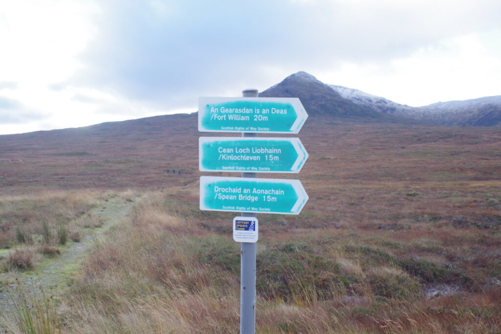
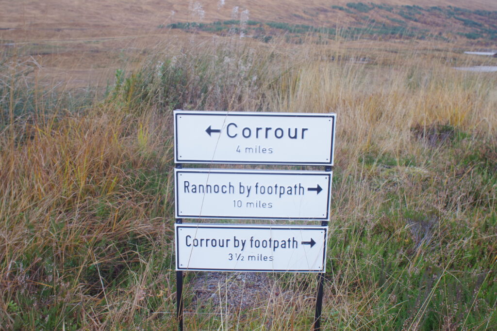
I’ve done some walking from Corrour before, mainly around Loch Ossian (a stay at the youth hostel is highly recommended) and to Loch Chiarain bothy (also a great spot). There’s two more bothies not far from the station that I’d like to see soon, but today was all about the trek to Rannoch. A quick look at the OS map beforehand showed that the navigation was reasonably easy, with a clearly-marked path all the way. It mostly passes along the side of a range of hills, suggesting easy gradients too – bonus!
So…off I went. First, a quick drive from my home in Winchburgh to Linlithgow, then a train to Glasgow, to pick up the 08.23 to Oban, Fort William and Mallaig. If you haven’t travelled on this line before, you have absolutely no idea what a treat you’re missing. After hugging the banks of the Clyde to Helensburgh, the train turns north and heads along the sides of lochs and through valleys, forests and mountains of increasingly spectacular splendour. The train divides at Crianlarich with one portion heading for Oban, and another to Fort William and Mallaig. The full journey to Mallaig takes over five hours, despite not actually being very far, as the train takes a leisurely pace over challenging terrain. Still, it gives you plenty of time to gawp out of the windows at the amazing scenery. Highlights include the Gare Loch and Loch Lomond, just as the line begins proper, with views over the Faslane submarine base, followed by views across the hills taking in Gorton bothy near Bridge of Orchy, and then the spectacular barren open spaces of Rannoch Moor, where the ground is so soft and wet that the track literally floats on a bed of logs. It was a major challenge to construct in such inhospitable terrain. Watch out for Horseshoe Curve too, where the train spectacularly does a U-turn around the bases of mountains.
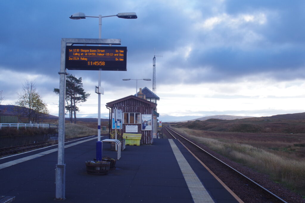
So…the journey from Glasgow to Corrour takes about three hours. The train was fairly quiet, being a Thursday morning in November, and I was rather hopeful I’d be pretty much alone on alighting at Corrour. However, when we called at Rannoch, quite a crowd got on, and bought tickets to Corrour, and I was surprised to be one of about twenty people alighting. What a disappointment! I hung around for a while as the crowds scattered in assorted directions – the station is at a hub of long-distance paths to a range of destinations. It’s famously remote – around seventeen miles from the nearest public road – but rather oddly has a very upmarket restaurant, open for only another couple of days before closing for the winter season.
The station also features in Trainspotting (“it’s shite being Scottish!”), but today’s travellers were a rather more hardy bunch. A few brave souls headed off to the rather scary looking snow-covered peak to the west of the station, a few others went to the restaurant, some others headed north, and few more headed towards Loch Ossian, the start of my own trek. I held back to explore the station a bit before leaving.
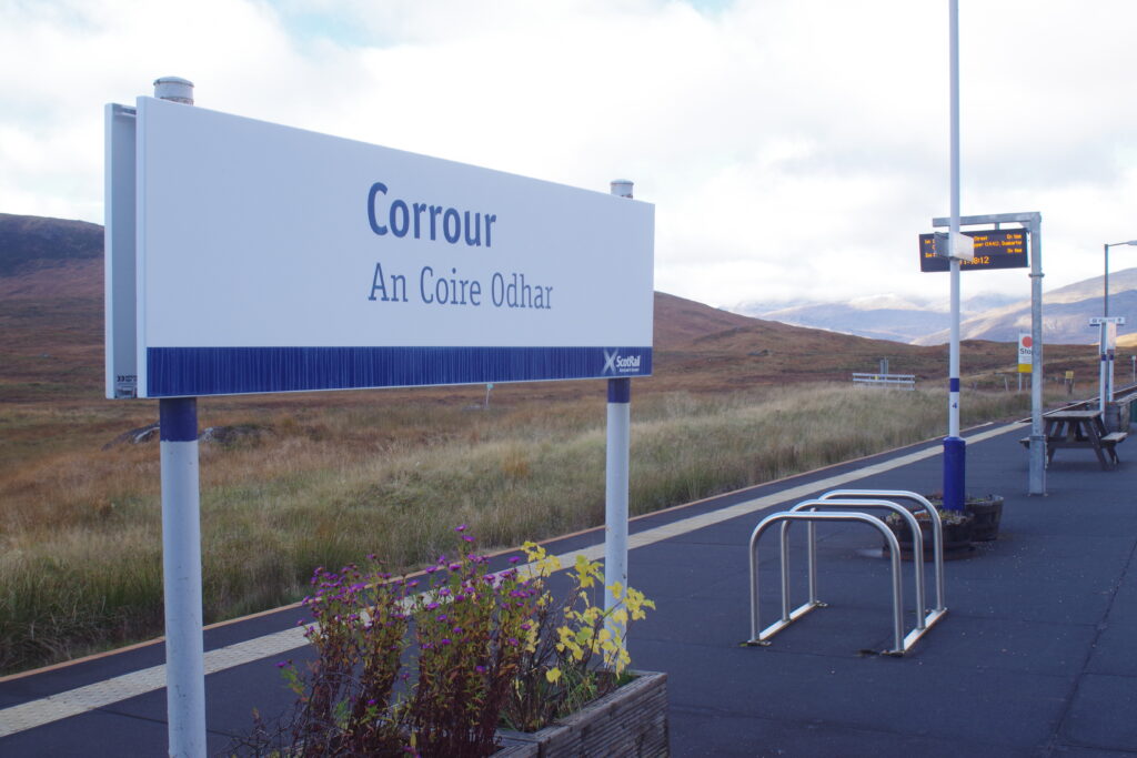
The station is the highest above sea level on the whole UK rail network, and just beyond it is the highest point on the West Highland Line, marked by prominent signs.
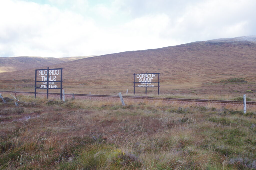
It’s not actually the highest point on the whole UK network – that belongs to Drumochter Summit on the Highland Main Line from Perth to Inverness, but there isn’t a station nearby, so it’s harder to reach. Anyway, this is a pretty spectacular spot!
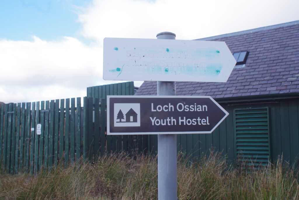
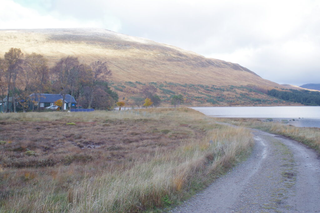
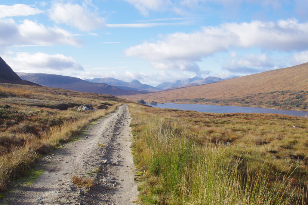
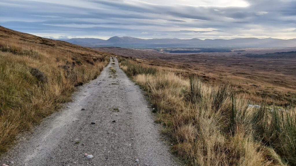
Being as high up as I was, I was soon getting pretty cold, so was keen to get active. Once the crowds had dispersed, it was time to get going. The walk starts with a gentle drop down from the station to the shores of Loch Ossian, and a more idyllic spot is hard to imagine. It’s home to Loch Ossian Youth Hostel, and staying here is a real treat. Beyond the hostel, I took a gently climbing path that gives you great views across the loch, heading along its southern shore. I saw a few mountain bikers heading back down the path the way I’d come, but the path is wide and easy and it didn’t present any challenges or problems. The altitude above sea level, as informed by my handheld GPS, gets to about 1700 feet, before the path takes a sharp right turn at Peter’s Rock. At this point, you’ve reached “cruising altitude”, and the path stays at roughly the same level to within about three miles of Rannoch, where it begins to gently descend again.
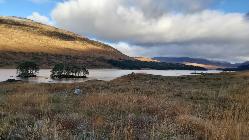
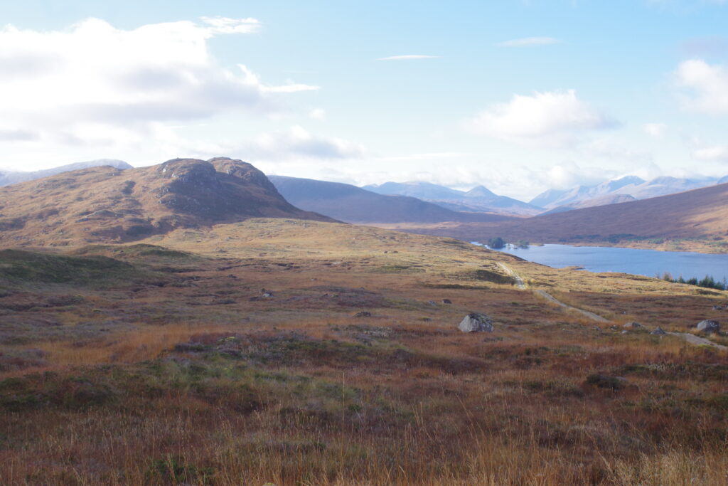
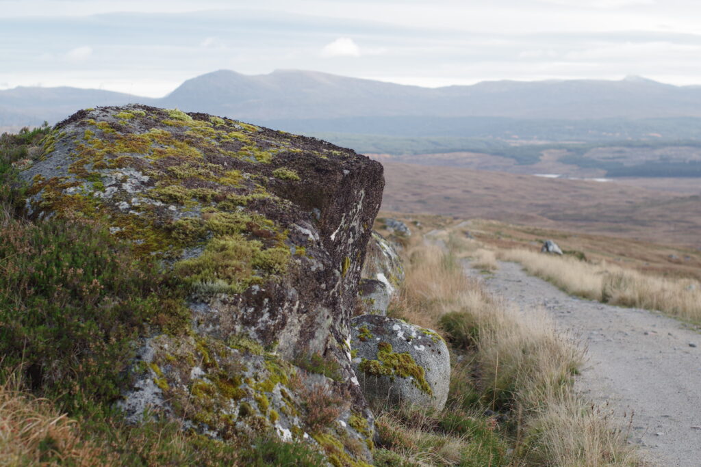
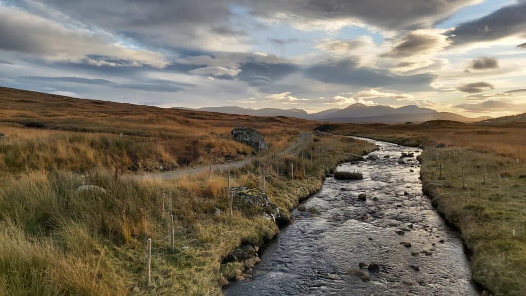
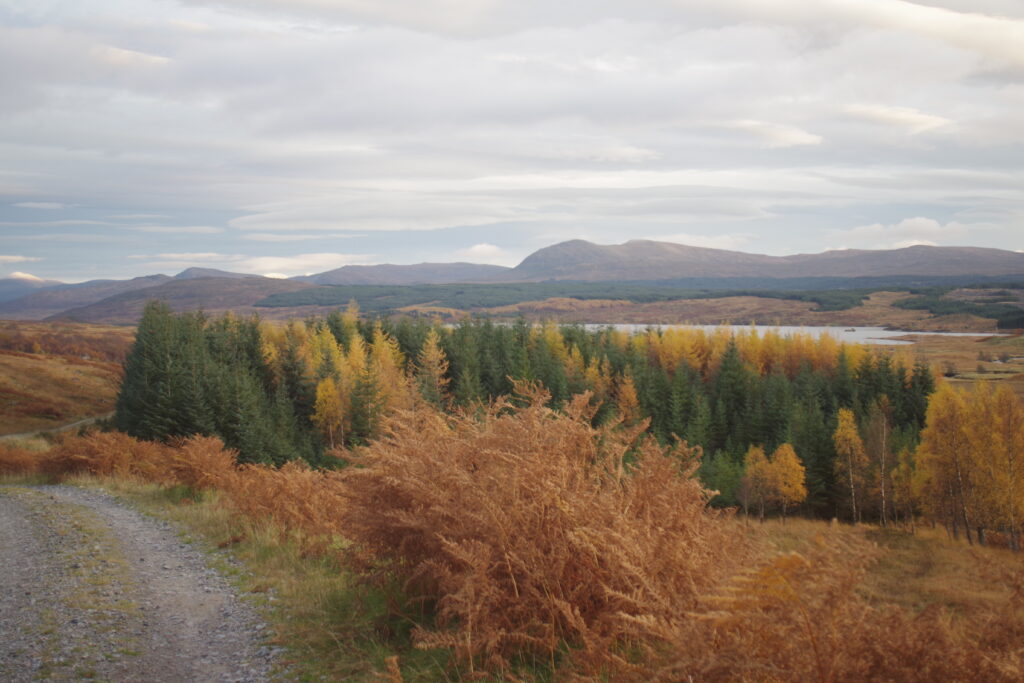
It doesn’t take long to leave the station and hostel behind, and feel like you’re in a very remote location indeed. The landscape is spectacularly wild, being one of the most significant and prized peat wetlands in the world. The ground is extremely soft and straying from the path isn’t a fantastic idea! Thankfully it’s not necessary, and I was happy to make my way through the spectacular scenery on the easy surface. To my left were steep ascents, to my right was a huge and glorious vista across the moor to rolling hills in spectacular bold colours, getting ever more spectacular as the day wore on and the sun began to set. Given that it was already November, I did extremely well with the weather, and had perfectly calm conditions all day. Not a drop of rain, and plenty of blue sky. It made the landscape look just about as perfect as it ever gets, and it made walking an easy pleasure. The only sound was my feet on the ground – when I stopped to stand still, I was stunned by just how silent everything was.
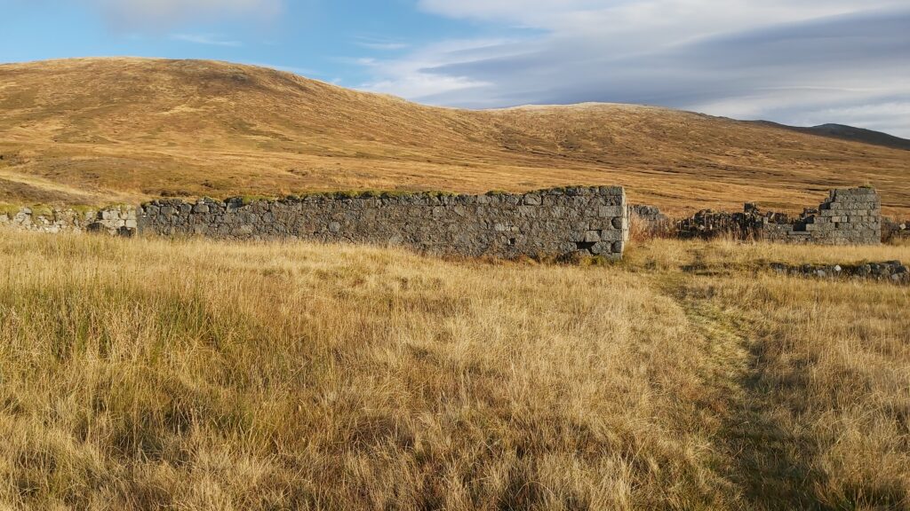
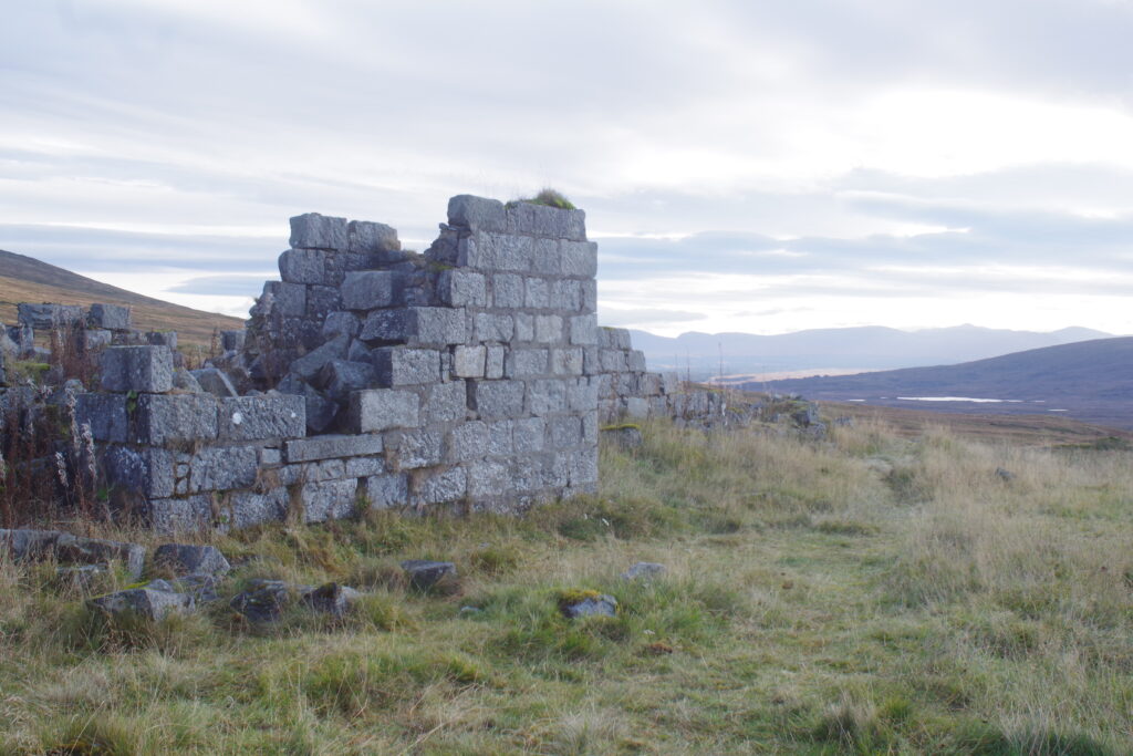
I didn’t come across any other people heading along the same path until I got fairly close to Corrour Old Lodge, now a spectacular hillside ruin. A couple of other walkers were exploring it, so I hung back and took some landscape shots before they got back on their way. Once they’d set off, I continued to the ruin, looked around and photographed it, and carried on once I’d put some space between us. They were soon out of sight and I was alone once more.
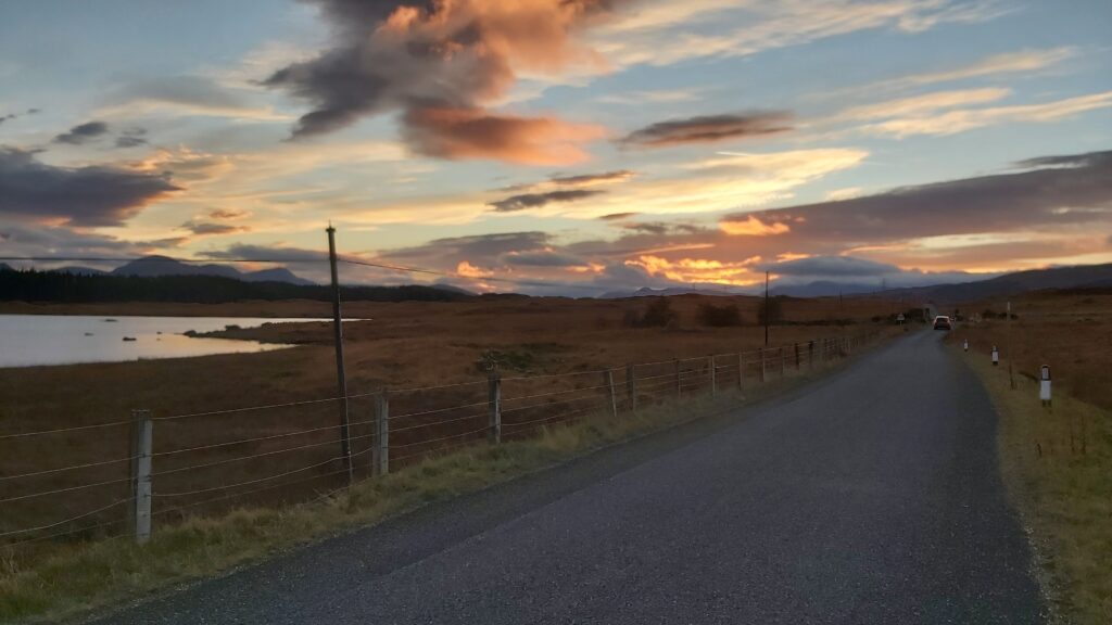
Eventually the path begins to drop gently as it curves down the hillside, and takes in some forestry plantations before turning to the south and heading down the final straight to Rannoch. I did see a few more signs of civilisation on this part of the walk, as the path gets wider to allow vehicular traffic to hydro-electric installations. I saw a few people at work as I passed one of these. Eventually I reached the B846, the road I needed to walk along for the last couple of miles back to Rannoch station. The road ends there – the sole reason for the B846 is to link this part of the world to civilisation, heading across lonely and wild terrain to the A9 near Pitlochry.
There was a geocache very near the junction with the B846, so I found it on my way back to the station. There was another nearby, atop a little hillock, but the terrain was a bit much for me after such a long hike. I didn’t really fancy having walked all that way, only to break my leg (or worse) doing something completely unnecessary.
Rannoch is only marginally more “built-up” than Corrour. There’s a hotel there, surrounded by lots of deer, which I was tempted to stay in, but it was fully booked the day I was there, and also somewhat pricy, so the plan was to get the evening train back to Glasgow. I had nearly two hours to wait when I got there, which I was concerned would be rather cold and miserable ones, but I soon had a very pleasant surprise. Although the station tea room was closed for the winter, the building remained unlocked, and in it was a supply of snacks, tea and coffee making facilities, and an honesty box to pay for it. What a result! I was able to sit down in comfort to eat my food, supplementing it with a Tunnocks caramel wafer and an extremely welcome warming cup of coffee.
I was very glad when my train turned up, and I was happy to doze my way back to Glasgow (there’s not much to see in the dark). It was about 10.30pm when I got home, and I’d been out since six in the morning, so it was a very long day, but an extremely satisfying one.
Technical notes for the geeks: navigation assisted by a Garmin eTrex 10, with basic maps showing the paths I needed to follow (OS map carried as backup but not needed). Route taken recorded by Garmin Forerunner 35 watch (see map below). Photos: Pentax K-S2 DSLR camera with Vivitar 28mm f2.8 manual focus lens, and Pentax FA 50mm f1.4 lens, and Samsung Galaxy A70 smartphone.